
by Rick Dickert
I first learned about the warming of the waters off of Peru, and its impact on the South Bay in 1983, during my freshman year at Redondo Union High School. Because my friends and I surfed, I was already deeply entrenched in the world of weather. I tracked it with my backyard weather station, which included a rain gauge, thermometer and barometer. My mentor was “Dr. George” Fishback, KABC-TV’s bow tie wearing weatherman. My grom friends and I we were enthralled with the ocean and how winds near and far impacted local waves

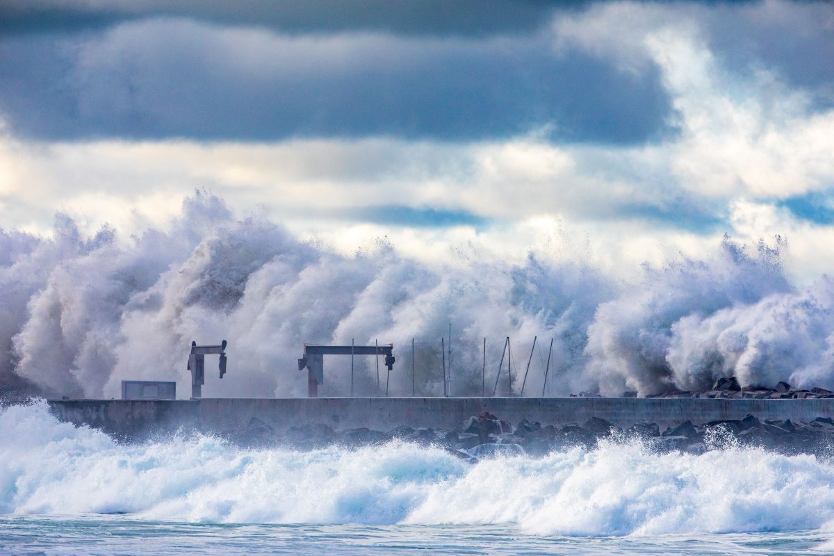
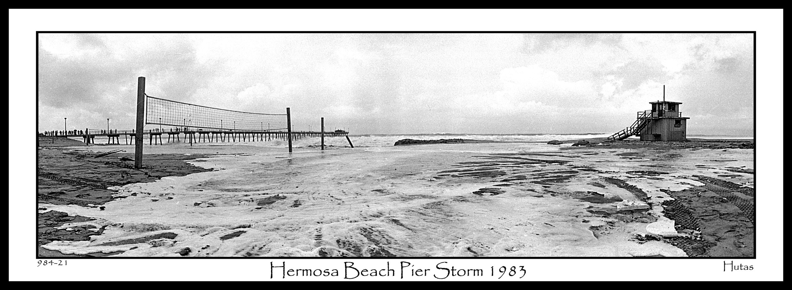
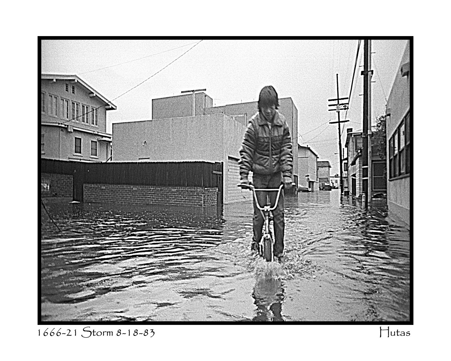
The South Bay winter of 1983 was epic on many levels. Almost 2.5 feet of rain was recorded in Hermosa Beach. Massive surf pounded King Harbor, breaching the breakwall, crossing the main channel, and washing through the Portofino Hotel lobby. A tornado destroyed part of the Los Angeles Convention Center
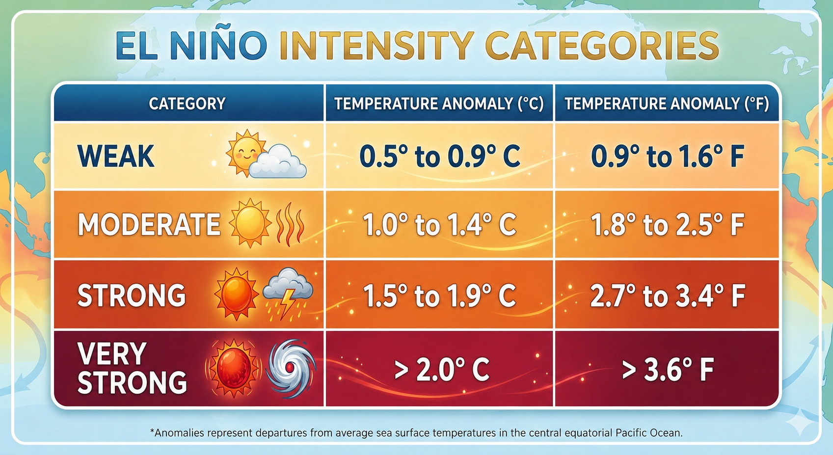
That year was one of just four very strong or “Super” El Niños on record. A “Super” El Nino requires the sea surface temperature anomaly to reach or exceed 2 degrees Celsius (3.6 degrees Fahrenheit).
Just half a degree
Once the equatorial Pacific Ocean (0 degrees latitude, Ecuador on our side of the Pacific; Indonesia on the other side) climbs 0.5 degrees Celsius (.9 degrees fahrenheit) above the normal water temperature for five consecutive years of three overlapping months, an El Niño pattern is officially in play.
Last Thursday, June 11, The NOAA National Weather Service Climate Prediction Center announced those conditions have been met. Some models show the coming El Nino could be the strongest ever recorded. (The strongest recorded El Nino in Los Angeles was the winter of 1997-88. Comprehensive government recording began in the early 1950s. Mariners logs go back centuries.)
South Bay groms grow up hearing about El Niño. The phenomenon is associated with torrential rains, gale-force winds, and epic swells. It results from the warming of the eastern equatorial Pacific Ocean. El Nino conditions develop every two to seven years and last nine to 12 months.
(La Niña is the opposite pattern, when ocean waters near the equator are cooler than average.)
El Niño is Spanish for “the little boy” or “the Christ child.” Christmastime was when 17th Century Peruvian fishermen first documented unseasonal warming of the waters off their coast. At Peru’s latitude, South American ocean temperatures are typically cooled by persistent upwelling of deep, nutrient-rich water. This process “fertilizes” the near-surface ocean, which helps produce microscopic phytoplankton. Marine life low on the food chain, like anchovies, feed on the plankton. El Nino’s warm waters choke off the typical upwelling, resulting in Peru’s fish population plummeting.

The next time you are down on the sand gazing at the horizon, remember this: you are looking at the world’s largest ocean. It covers 63.8 million square miles or about a third of our planet. Anything that happens to this massive body of water massively impacts you.
Warming of the ocean in the equatorial Pacific lifts heat and moisture into the atmosphere, which fuels the jet stream (storm track) that carries storms across the Pacific to our west coast.
The stronger the El Nino, the further south the jet stream falls. In a typical year, the jet stream flows over the Northwest. In 1983, the jet stream unloaded over the South Bay.
(During La Niña years, the jet stream shifts west, well off our coast, towards the Central Pacific, reducing rainfall for our region.)
It’s important to note, not all El Niños bring wet winters to Southern California. The most recent “Super” event, in 2015-16, produced fewer than 10 inches of rain in Los Angeles. No two El Niños are alike because other atmospheric and oceanic conditions play into how our water year goes.
Very Strong “Super” El Niños, Los Angeles rainfall
1887-88 21.26” (Strongest on record)
1982-83 31.25”
1997-98 31.01”
2015-16 9.65”
Last week’s Climate Prediction Center “El Niño Advisory” reported that sea surface temperature anomalies are now at +0.7° C (1.26 degrees fahrenheit), well above the 0.5° degree threshold needed for an El Niño to begin. Forecast models indicate that there is a 100% chance of these conditions continuing through at least January 2027, with a 63% chance that this event will be a “very strong,” and possibly the strongest ever recorded.
From the mountains to the seas
The equatorial Pacific will continue to warm this summer as will ocean temperatures off of Southern California. Locally, July through September air temperatures will likely be warmer, and also more humid than normal.
If the forecast for a “very strong” El Niño comes to fruition, there is a good likelihood of powerful Pacific storms and large, long period WSW-NW swells hitting the South Bay.
For snowboarders and skiers, El Nino’s impact will depend on how “tropically induced” the Pacific storms are. A strong southwesterly atmospheric fetch along with Atmospheric Rivers will raise the snowline elevation, resulting in rain mixed with some snow at lower elevations ski resorts. However, for higher elevation resorts like Mammoth (base elevation 7,953 feet;summit 11,053 feet), the likelihood of persistent heavy snowfall is greater. About 70% of significant El Niño events have produced above average snow totals for mountain resorts.
Ocean and atmospheric systems are complex, and forecasting their interaction even more complex.
But the Redondo High grom in me predicts big waves and deep powder for the upcoming California winter.
Rick Dicker is a certified broadcast meteorologist. He reported on weather for KFOX 11, from his “corner office at 1,000 feet” in a helicopter for over three decades. Comments and questions about this article may be sent to RickDickertWeather@gmail.com ER


Great information Rick, thank you for sharing your knowledge and experience with the South Bay.