Redondo Beach introduces real-time street sweepers digital map
by Garth Meyer
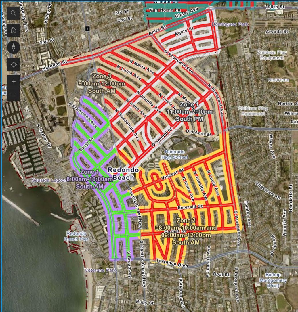
Redondo Beach Police have launched a new digital mapping tool to manage street-sweeper routes and inform the public about them. The Geographic Informations Systems (GIS) project gives residents updates in real-time each day – what the schedule is and when each street is finished being cleaned – so people know when they can move their cars back and avoid parking tickets. “This innovative tool is a major step forward in making street sweeping and parking enforcement more efficient and convenient for the residents of Redondo Beach,” said Police Chief Joe Hoffman. “… This ensures that our community stays informed, reduces the frustration of unnecessary fines, maximizes availability of parking options, all while supporting our collective effort to keep Redondo Beach clean.” Last September, the city council amended city code to formally allow people to park their cars on the street once the sweeper and parking enforcement officer has gone by. With the new GIS program, the city has a digital map on the RBPD website listed by neighborhood, showing both the daily street sweeper updates and coming schedules. On the map, streets colored red mean do not park; green means sweeping and enforcement have been through and restricted parking has lifted. The maps may be found at redondo.org/departments/police
Comments
Loading comments…